
Page 20 - Biodiversity and Conservation Framework
P. 20
Biodiversity & Conservation Framework
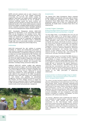
SADRI conducted analytical work on water resources in the Investments
Pafuri-Sengwe Node of the Great Limpopo Transfrontier
Conservation Area (GLTFCA), with activities including the The Zambezi River Basin Development Project supported
mapping of flood plains and wetland systems, assessing water detailed feasibility, environmental, and social studies to prepare
demand and usage, understanding the role of wetlands in for the infrastructure development of the Batoka Gorge
community livelihoods support and climate resilience, and Hydroelectric Power Station project. While large-scale water
evaluating governance practices to manage water resources. Key infrastructure projects such as dams carry substantial risks to
biodiversity benefits of this activity include inventories, analytical biodiversity, the studies aimed to minimize those risks to the
and technical support, knowledge-sharing, provision of ecosystem extent possible.
services, improved ecosystem integrity, sustainable agricultural
and resource harvesting practices, and groundwater protection. Current Project Examples
SADC Groundwater Management Institute (SADC-GMI) Enhancing Niger Basin's Ecosystem through
supported the development of the Groundwater Information Modelling and Improved Decision-making
Portal and the Groundwater Grey Literature Archive, which The Inner Niger Delta, a vast floodplain within the arid and
contains publicly available data on groundwater resources. The semi-arid Sahel region, is the second largest wetland in
institute also produced core guidelines and gap analyses to Africa and rich in natural resources. It is vitally important to
support the evidence base for cooperation on transboundary the 900,000 people in Mali who depend on its waters for
aquifers. Both activities are indirectly linked to biodiversity fishing, agriculture, crafts, tourism, and other livelihoods.
through their focus on groundwater protection and recharge, During the rainy season, water levels can rise by as much as
creation of decision-making tools, and knowledge-sharing.
four meters in just 100 days, sustaining the local population
Institutions and hundreds of thousands of birds and livestock.
Designated a Ramsar Wetland of International Importance,
the Delta is crucial for protecting biodiversity, promoting
SADC-GMI implemented five joint activities to generate sustainable development, and ensuring food security.
knowledge on national and transboundary groundwater. A However, it faces significant strain from climate change,
water resources management research project was conducted reduced flooding, an upstream dam, sand extraction for
in the Shire River Basin, a transboundary diagnostic analysis and construction, and water extraction for irrigation.
an action plan are under development for the Tuli Karoo, and
preparatory work is under way in the Eastern Kalahari, CIWA's analytical support has helped the NBA develop an
Ramotwsa, and Strampriet River Basins. These activities provide advanced model for Delta ecosystem services, improving
key direct and indirect benefits to biodiversity action through the prediction of impacts of upstream structures and
groundwater protection and recharge, provision of ecosystem enabling informed decision-making regarding various water
services, improved species diversity and connectivity, data release patterns of planned infrastructure investments. This
generation, knowledge-sharing, and decision-making tools. model will aid in conserving the region’s biodiversity.
Additionally, CIWA financed a decision-making process
Additional SADC-GMI activities enabled data gathering, concerning the environmental and social risks of the
analytical and technical support, and decision-making support. proposed Fomi dam in Guinea, which led to the selection of
The institute led the Groundwater Governance Working Group a new site. CIWA has also been strengthening the overall
at the African Ministers’ Council on Water to implement the capacity of the NBA, particularly in biodiversity
Pan-African Groundwater Program (APAGroP). It opened conservation.
project-based positions for young professionals of member
states related to the expansion of the SADC Groundwater
information portal. SADC-GMI produced Gap Analysis Reports Analytical Work to Fill Knowledge Gaps in Water
for each member state, guidelines for groundwater Production, Use, and Governance in the GLTFCA
management, roadmaps for institutional frameworks in Eswatini Pafuri-Sengwe Node (SADRI)
and Tanzania, and three strategic analyses to support the
evidence base for cooperation. Finally, the institute participated The project provided technical support to the GLTFCA to
in eight international research platforms where it disseminated enhance understanding of water governance and use in the
research results pertaining to groundwater management. Pafuri-Sengwe Node, thereby informing community-level
drought preparation and mitigation measures. The analytical
work focused on key water systems, including the Limpopo,
Mwenezi/Nuanetsi, Luvuvhu, and Bubye Rivers, directly
supporting and improving governance within the GLTFCA.
A critical component of this effort was to enhance water
resources knowledge and data management, particularly
baseline information on wetlands, groundwater, and their
interactions with surface water resources.
The project's objectives were to determine the extent of
water availability in targeted aquifers, wetlands, and river
systems; assess water demand and usage among
communities in the Pafuri-Sengwe Node; evaluate
governance practices for water management; and, based on
these assessments, identify, develop, and recommend near-
and medium-term actions and investment opportunities for
water management that enhance community drought
resilience.
16