
Page 111 - CIWA Water Data Revolution Overview Report
P. 111
Additional data like Leaf Area Index (LAI) and Net Primary Productivity (NPP) are also used.
Static data sources, including soil moisture, digital elevation, and landcover, were also
incorporated. The availability of measured discharge and precipitation data for the Zambezi
basin provided a basis for extensive validation of the water accounting model. All datasets
used for Zambezi basin, cover the period from 2003 to 2023. This is because, remote sensing-
based actual ET was only available from 2003, and 2023 was the last full year for which data
was available when the generated discharge data for the water accounting model was
developed. However, with more recent data are now being available, this is easily updated. A
comprehensive table of these data sources is available in Annex 3.1.
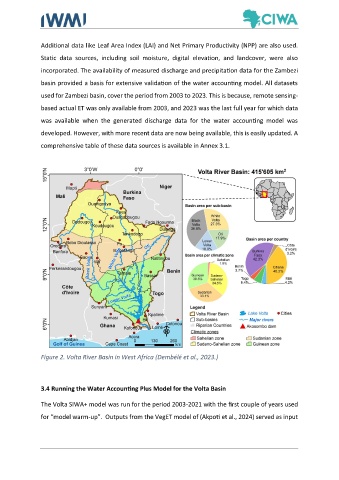
Figure 2. Volta River Basin in West Africa (Dembélé et al., 2023.)
3.4 Running the Water Accounting Plus Model for the Volta Basin
The Volta SIWA+ model was run for the period 2003-2021 with the first couple of years used
for “model warm-up”. Outputs from the VegET model of (Akpoti et al., 2024) served as input