
Page 61 - CIWA AR25
P. 61
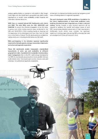
Cross-Cutting Themes: Water Data Revolution


           analysis, gaining hands-on  experience  with  platforms  like  Google   of sharing in-situ data across borders, promoting transparency and
           Earth Engine and the World Bank’s geospatial tools, which enable   trust—critical ingredients for regional cooperation.
           organizations  to  monitor  water  availability,  predict  hazards,  and
           make data-informed decisions.                      The work developed under WDR establishes a foundation for
                                                              the  future  implementation  of  basin‑wide  analytical  tools,
           WDR  then  co‑created  tailored  WA  Dashboards  with  clients   enabling the practical and integrated use of data in decision
           and  IWMI.  The  pilot  RBOs  were  the  VBA,  INMACOM,  and   making.  Moving  forward,  a  more  focused  approach  will  be

           ZAMCOM.  To  ensure  the  effective  integration  of  the  WA  tools,   required  to  address  the  specific  and  unique  needs  of  each
           in-person and online training sessions were conducted for the   RBO, necessitating detailed assessments of their requirements.

           VBA  and  INMACOM  in  2024,  enabling  hands-on  learning  and   Additionally,  future  efforts  must  consider  the  significant
           the application of the developed tools (see View from the Field   variations in existing capacities among RBOs, ensuring that tools
           story on Dr. Rafatou Fofana). The WA dashboards are available for   are developed with these differences in mind.
           various end-users, including line Ministries and RBO staff.
           RBOs  participating  in  the  initiative  reported  significantly

           improved technical capacity, stronger ownership of data tools,
           and enhanced regional cooperation.
           These WA dashboards enable transparent, standardized
           assessments  of  water  use  and  availability  at  different
           geographical scales—foundational for sustainable transboundary
           water management. Built on the WA+ methodology developed by
           the IWMI, the dashboards are powered entirely by satellite-derived,
           public domain data. This ensures open access, reduces costs, and
           sidesteps the political and logistical complexities


                                                                                                           61